
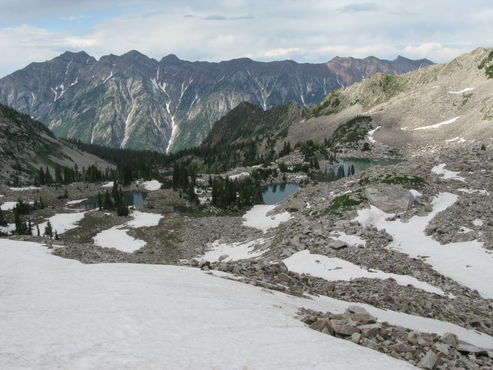
Good times. This year I got started right around noon by myself and followed the trail to Upper Red Pine Lake. Past that point the trail disappears, so I bushwhacked through the scree above the lakes. I made two significant mistakes here. First, I went to the east of the upper lake even though I knew that I would need to work my way to the west to actually summit the Pfeifferhorn. Furthermore, instead of trying to gain the ridge as quickly as possible and then taking a leisurely ridgewalk to the foot of the Pfeifferhorn, I traversed across scree and snow fields a couple hundred yards below the ridge for far too long. These mistakes probably added an hour and a half to the time that it took me to get up, but I did get a fantastic view of the Red Pine Lakes while I was traversing above them:
When I finally got to the ridge, I discovered that there's actually a very nice trail along the top of it. I walked west along the ridge for a while and made some 3rd class moves to get to the base of the Pfeifferhorn. I was pretty exhausted by this point and was not a happy camper when I finally looked up at the summit block and realized that I still had about 400 feet of vertical to climb to get from the ridge to the top:

This was probably the closest I came to turning around all day. I was really tired and walking along at 11,000 feet had really take its toll on me, but fortunately I kept going. By going a bit to the left of the ridge, I found a decent path up and 45 minutes later I was looking down from the 11,326 ft summit. (If I remember right, it only took me something like 18 minutes to get down. I was that tired going up.) The view from the top was absolutely amazing. I took a panorama that now serves as the background for the title of this blog. I also took a nice image looking east at White Baldy, Red Baldy, Red Top, the American Fork Twins, Hidden Peak, and Baldy. Yes, White Baldy, Red Baldy, and Baldy are a different mountains and they're all in this picture:

I made it down 3 hours or so after leaving the summit, which was only a bit more than half the time it took me to get to the top. Apparently my route finding on the way up really was just that bad. Still, this hike counts as one of the high points of the last 8 months and maybe of the last 21 years. I suspect that few if any metastatic melanoma tumors have ever visited such a beautiful place. I'm very grateful that I had the strength to make it up an amazing peak after such a stressful week, although I'm pretty sure that making it up that last stretch to the summit was more a matter of willpower than strength. Fighting melanoma has truly been miserable, but the motivation to get out and climb mountains has certainly been one of the bright spots, and this hike was a prime example of that.


